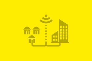

Remote sensing for precision agriculture

How did we create impact?
With over 30 organizations from the agriculture and technology space, we developed a two-fold solution to enable the scale-up of ag-tech solutions by being promoted and applied by existing extension agents in Nigeria, both public and private. By making satellite-enabled ag-tech services available and affordable for smallholder farmers, via extension workers, these interventions will enable small farmers to become more productive and resilient. Services such as advisory, credit, insurance, or marketing of crops will allow farmers to manage their farms better, invest more, achieve greater yields, and manage risks more effectively. If you want to know more about this solution, contact Christina.
For more information see our Concept Note.


What is remote sensing technology doing for precision agriculture?
Remote sensing data provides relevant information for small farmers as well as potential business partners, including on soil, water, plant growth, pest and disease as well as weather-related damages. With appropriate services, small farmers can use this information to manage their farms more effectively. Insurance companies can better assess risks and damages, finance providers can build better credit profiles, and buyers can better predict and plan for yields. Remote sensing data can thus inform comprehensive risk management solutions.

Why do we need an inclusive and resilient agricultural system?
Smallholder farming is characterized by the need to avoid risk. Because small farmers are exposed to a multitude of risks but have few assets to manage a hit, they typically divert their effort into other income sources and invest just enough into the farm to subsist. Providing small farmers with a complete risk management solution, including advisory, access to markets, finance and insurance, allows them to manage their farm as a business, increase productivity and incomes. Satellite data enables all these services, making them more accurate and affordable.